Stop 1 of 6 · Intro & 01 Atlas (0:00–0:30)
Where is the ground sinking? 29 basins on one 93-day ruler.
We turned the first months of NASA-ISRO NISAR radar data into a self-checking global subsidence atlas: 29 basins (15 reliable, 14 indicative) measured with one open pipeline on the same 93 days (28 Jun – 29 Sep 2026), led by Eloy, Arizona at −8.6 cm/100d; Konya Plain (−11.0) stays indicative after our own review.
Source: Data: NASA-ISRO NISAR, ASF DAAC. Analysis: Team Aseltech (data/global/atlas.json, data/global/home_summary.json).
| Rank | Region | Common (cm/100d) | Confidence |
|---|---|---|---|
| 1 | Eloy (USA) | −8.6 | high |
| 2 | Central Valley (USA) | −7.3 | medium (GNSS r=0.924) |
| 3 | Kashmar (Iran) | −7.0 | high |
| 4 | Mashhad (Iran) | −6.9 | medium |
| 5 | Mexico City (Mexico) | −6.3 | medium |
Stop 2 of 6 · 02 Self-Checking QC (0:30–1:00)
A check that catches our own errors
Automated time-series checks flagged 12.1 cm full L-band phase-cycle jumps; Semarang dropped from −12.1 to −6.2 cm (#7 reliable), Tehran updated −3.5 to −7.4 cm, and 5 flagged basins stay indicative only.
Source: Analysis: Team Aseltech (tools/atlas_qc.py, data/global/qc_flags.json, data/global/atlas_changelog.json).
Stop 3 of 6 · 03 GPS & Validation (1:00–1:30)
Proof on the ground and uncertainty
Provisional NISAR motion tracks 10 permanent Central Valley GPS stations (r = 0.924, 1.00 cm median RMSE), beats ≈ 0.3 cm formal phase noise, and includes a Mexico City OPERA pattern check (r = 0.912, winter vs summer).
Source: Data: NASA-ISRO NISAR, ASF DAAC; NGL GNSS; NASA JPL OPERA. Analysis: Team Aseltech (data/central_valley/validation.json, data/global/opera_check.json).
Stop 4 of 6 · 04 People & 05 Water Lost (1:30–2:00)
1.17 M people on sinking ground & 0.3174 km³/yr water lost
Overlaying GHSL 2025 population counts 1,167,429 residents on 477.72 km² sinking > 5 cm, while 11 months of NISAR data isolate 0.3174 km³/yr of permanent Central Valley aquifer storage lost.
Source: Data: NASA-ISRO NISAR, ASF DAAC; GHSL E2025. Analysis: Team Aseltech (data/global/vital_signs.json, data/central_valley_fullyear/storage_loss.json).
Stop 5 of 6 · 06 Infrastructure & 07 Bulletins (2:00–2:30)
81 / 645 tilting corridors & 29 one-page bulletins
Every canal, road and railway in the Central Valley is screened for uneven sinking with uncertainty bounds, and every atlas basin gets a printable one-page NASA-style monitoring bulletin.
Source: Data: NASA-ISRO NISAR, ASF DAAC; OpenStreetMap. Analysis: Team Aseltech (data/central_valley/assets.json, tools/bulletin.py).
Stop 6 of 6 · 08 Simulator & 09 Open Engine (2:30–3:00)
A 30-second simulator & an open one-command engine
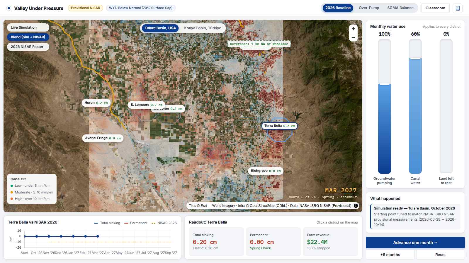
Test 24 months of pumping choices in the NISAR Vision groundwater simulator, calibrated to NISAR rates, or reproduce any basin from public NASA ASF data with one open command.
Source: Model calibrated to USGS/NGL Terra Bella compaction and NISAR rates (game/model.js, pipeline/nisarvision).