Peak Cumulative (LOS)
-9.6 cm
Vertical Est. (37.6°)
-12.1 cm
3-Ref Sensitivity
[-14.0, -9.6] cm LOS
Rate (cm / 100 days)
-8.9 cm/100d
Annualized est.: -32.5 cm/yr
Latest Pair & Cumulative Summary
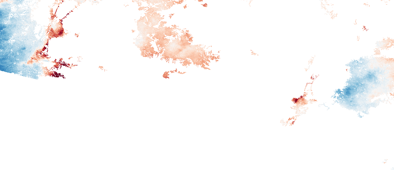
- Latest Consecutive Pair Step: +0.59 cm LOS (2026-09-30 to 2026-10-12 at p01: 37.816N 32.628E; cumulative at point: -9.60 cm)
- Affected Population (GHSL GHS-POP E2025, 108d eq., ≥ 0.66 cm 2σ): 138,718 residents (< -2 cm), 33,287 residents across 33.93 km² (< -5 cm).
Top 3 Most-Subsiding Areas
| Rank | 1 km Block Center (Lat, Lon) | Cumulative LOS | Rate |
|---|---|---|---|
| #1 | 37.8161, 32.6278 | -9.60 cm | -8.89 cm/100d |
| #2 | 37.8630, 32.6276 | -6.57 cm | -6.08 cm/100d |
| #3 | 37.9755, 32.6270 | -6.31 cm | -5.84 cm/100d |
Top 5 At-Risk Infrastructure Segments
Infrastructure corridor ranking (OSM canal/road overlay) has not been computed for this regional subset yet.
GNSS Comparison & Calibration Status
Continuous GNSS time-series validation was not bundled for this regional subset.
Cumulative Displacement Map
What This Means
- Peak measured ground motion in Konya Plain (Türkiye) reached -9.6 cm LOS (-8.9 cm/100d) from 2026-06-26 to 2026-10-12, but low coverage or wide reference spread makes this an indicative estimate.
- About 138,718 residents live on ground sinking faster than 2 cm per 108 days (and 33,287 residents across 33.93 km2 faster than 5 cm per 108 days, above the 0.66 cm 2-sigma noise floor).
- No local GNSS or canal-tilt overlay is bundled for this subset; field inspection and local piezometer records are needed to confirm infrastructure impacts.
Calibration & Quality Notice (PROVISIONAL): NISAR data are provisional. Calibration and validation are carried out by the NISAR project (NASA-JPL and ISRO), not by our team.
Sources: NASA-ISRO NISAR L2 GUNW (CRID P05023 via ASF DAAC); GHSL GHS-POP E2025 R2023A (JRC, CC BY 4.0); Nevada Geodetic Laboratory GNSS; OpenStreetMap (ODbL).
Sources: NASA-ISRO NISAR L2 GUNW (CRID P05023 via ASF DAAC); GHSL GHS-POP E2025 R2023A (JRC, CC BY 4.0); Nevada Geodetic Laboratory GNSS; OpenStreetMap (ODbL).